


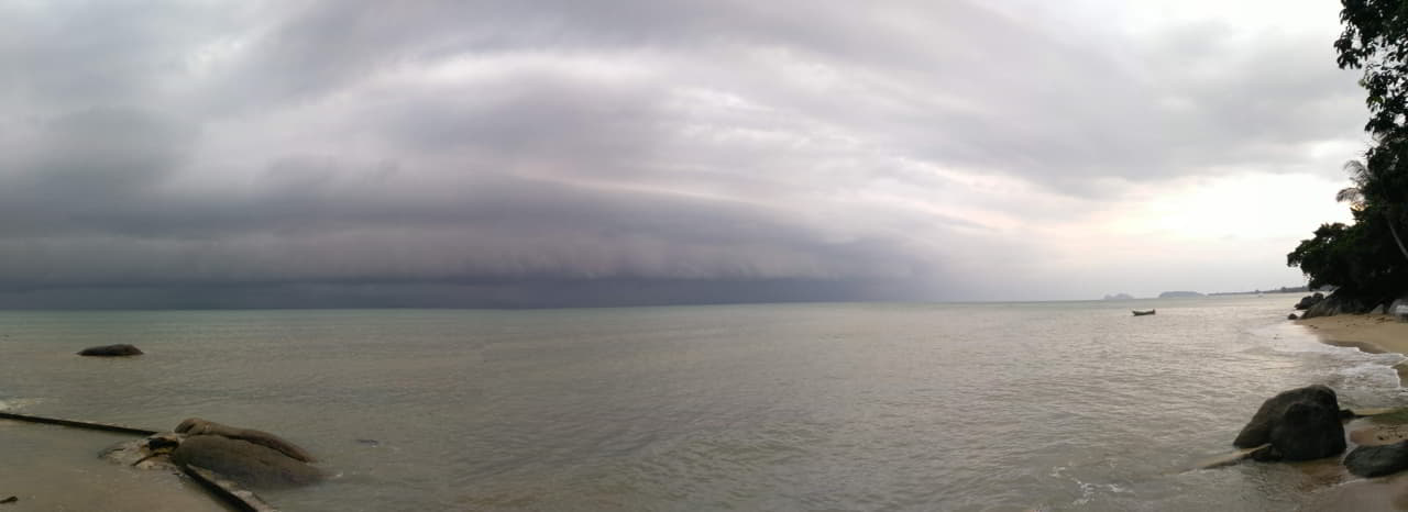
Thailand: Heavy Rain, Flooding and Travel Disruptions on September 26–27
Écrit par la rédaction de theo-courant.com, votre guide de référence sur la Thaïlande et l'Asie du Sud-Est.

Heavy rain continues to affect several parts of Thailand this weekend. Bangkok, Pattaya and the eastern provinces are among the areas concerned, with local flooding and disruptions possible on roads and other transport routes.
Key points: Thailand weather on September 26–27

- September 26–27: Thailand’s Meteorological Department (TMD) continues to forecast heavy to very heavy rain in several regions.
- Bangkok and surrounding areas: heavy rain remains possible, with local water accumulation in vulnerable areas.
- Pattaya and Chonburi: local flooding and traffic disruption have already been reported.
- Eastern Thailand: Chonburi, Rayong, Chanthaburi and Trat remain among the provinces affected by heavy rainfall.
- Road travel: major routes remain usable in several areas, but journey times can increase significantly during periods of intense rain.
- Sea conditions: waves can reach 2 to 3 metres and exceed 3 metres in thunderstorms in some areas.
- Pattaya on September 26–27: the Pattaya Marathon is also causing temporary road closures and traffic restrictions this weekend.
A weather situation that has been developing since September 23
The deterioration in weather conditions forecast by the Thai Meteorological Department (TMD) is now well underway.
In its September 26 bulletin, the TMD forecasts heavy rain in several regions, with isolated very heavy rain possible across the North, Northeast, Central Thailand, Bangkok and its surrounding areas, the East and the upper South.
The department is advising people to remain cautious because intense rainfall can lead to rapid runoff, sudden flooding and water accumulation, particularly in low-lying areas, near waterways and at the foot of hills.
In eastern Thailand, the provinces of Chonburi, Rayong, Chanthaburi and Trat remain among the areas affected by heavy rainfall.
The situation is therefore no longer simply a matter of weather forecasts. Several areas have already experienced flooding and traffic disruption since the beginning of the current episode.
Pattaya: several roads affected by flooding
Pattaya is one of the areas where the heavy rain has had a direct impact on travel.
Periods of intense rainfall have caused significant water accumulation in several parts of the city. Areas around Sukhumvit Road, South Pattaya, Central Pattaya, Beach Road, Soi Buakhao and parts of eastern Pattaya have been affected.
In the worst-affected locations, water has reached several tens of centimetres, with some particularly exposed areas reporting much deeper flooding. Some sections of road have temporarily become difficult or impossible for smaller vehicles to cross.
Conditions can change quickly once the rain stops. Some roads return to normal as water recedes, while new problems can appear during another intense downpour.
Pattaya–Bangkok: the route remains possible, but expect delays
Travel between Pattaya and Bangkok remains possible by car or bus, but journey times are more unpredictable than usual.
Major roads can remain open while urban areas along the route are simultaneously affected by water accumulation. As a result, traffic can slow considerably, particularly during periods of heavy rain.
Based on our observations on the ground, the Pattaya–Bangkok route remains usable, but travellers should allow extra time for the journey and check traffic conditions before leaving.
The disruption is not limited to Pattaya. Flooding has also affected several roads in Chonburi province, including parts of Highway 331.
Sukhumvit Road: local disruption around Pattaya and Jomtien
In Pattaya and around Jomtien, Sukhumvit Road is among the routes that can be affected when rainfall becomes particularly heavy.
Water accumulation has already caused slower traffic on several sections of the road, with conditions varying considerably from one area to another.
It is therefore important not to treat Sukhumvit Road as if it had uniform conditions along its entire length. One section may remain passable while another, only a few kilometres away, is affected by significant water accumulation.
Travellers leaving Jomtien or Pattaya for Bangkok, the airport or other destinations should therefore allow additional travel time.
Pattaya and Jomtien: additional traffic restrictions this weekend
Weather conditions are not the only factor likely to affect traffic in Pattaya this weekend.
The Pattaya Marathon 2026, taking place on September 26–27, is causing temporary road closures and traffic changes across several parts of the city.
On Saturday, September 26, several roads in the central and beachfront areas are affected.
On Sunday, September 27, restrictions are more extensive and include Jomtien Second Road, Jomtien Beach Road and parts of Sukhumvit Road, with closures, changes to traffic directions and diversions depending on the location.
Anyone travelling between Pattaya, Jomtien and the main highways should therefore take both the weather and the marathon traffic arrangements into account.
Road towards Chanthaburi temporarily closed
The situation also requires attention further east.
Heavy rain has caused disruption on several roads in eastern Thailand, particularly in Chonburi, Rayong, Chanthaburi and Trat provinces.
A road towards Chanthaburi was temporarily closed yesterday evening before reopening this morning.
This illustrates how quickly road conditions can change depending on rainfall and water accumulation.
Anyone travelling towards Chanthaburi or Trat should therefore check the latest road conditions immediately before departure rather than relying solely on conditions observed several hours earlier.
Bangkok: heavy rain remains possible
Bangkok and its surrounding areas also remain within the current weather system.
The TMD’s September 26 forecast calls for thunderstorms across much of the area, with heavy to very heavy rain possible in several locations.
Water accumulation can temporarily affect traffic, particularly in parts of the city that are more vulnerable during intense rainfall.
This does not mean that Bangkok as a whole is flooded. Conditions can vary considerably between neighbourhoods and may change rapidly during the day.
Travellers arriving in or leaving Bangkok should therefore allow additional time when heavy rain is forecast or already affecting the city.
Sea conditions remain difficult in some areas
The weather system is also affecting coastal and maritime areas.
In eastern Thailand, the TMD forecasts waves of 2 to 3 metres, with higher waves possible in thunderstorms.
Small boats should exercise particular caution in the Gulf of Thailand. Conditions can deteriorate rapidly when thunderstorms develop.
Boat excursions and crossings should therefore be assessed according to actual conditions at the time of departure.
Travellers should follow the latest weather information and any instructions issued locally by operators and maritime authorities.
Which parts of Thailand are most affected?
Heavy rain is affecting a large part of Thailand, although some regions require particular attention.
| Region | Situation on September 26 |
|---|---|
| Bangkok and surrounding areas | Heavy to very heavy rain possible, with local water accumulation |
| Chonburi / Pattaya | Local flooding and traffic disruption already reported |
| Rayong | Heavy rain and risk of water accumulation |
| Chanthaburi | Heavy rain and potential travel disruption |
| Trat | Heavy rain and difficult sea conditions |
| Central Thailand | Several areas affected by heavy rain |
| North and Northeast | Heavy rain in several provinces |
| Upper South | Heavy rain in several areas |
The TMD’s heavy-rain warning remains in effect through September 27.
What should travellers expect?
The current situation does not mean that travelling around Thailand is impossible.
Major road journeys remain possible, including travel between Bangkok and Pattaya, but journey times can become significantly longer when rainfall is intense.
In Pattaya and Jomtien, some roads may temporarily become difficult to use because of water accumulation. Further east, conditions can also change quickly, as demonstrated by the temporary disruption on roads towards Chanthaburi.
For travel planned on September 26 or 27, it is therefore advisable to:
- check the latest TMD forecast before setting out;
- allow extra time for road journeys;
- avoid roads already reported to be flooded;
- check local road conditions before travelling towards Chanthaburi or Trat;
- check traffic restrictions in Pattaya related to the marathon;
- postpone boat trips if sea conditions deteriorate.
Weather forecasts and road conditions can change rapidly. Local information should therefore be checked immediately before each journey.
Follow Thailand news

Sources
- Thai Meteorological Department (TMD), weather bulletins issued on September 25 and 26, 2026.
- Pattaya Mail, reports on flooding and traffic conditions in Pattaya.
- The Nation Thailand, reports on weather conditions and flooding in eastern Thailand.
- Local traffic information and Pattaya Marathon 2026 road-closure arrangements.